Surveying river health along the New South Wales rivers
The team from Surface Water Science surveys channel features and long-term impacts to geomorphic condition as part of the NSW River Styles project. The geomorphic team conducts desktop Digital Elevation Model (DEM) and aerial imagery assessments with field trips to survey sites along selected rivers from headwaters to estuaries or anabranch junctions with downstream rivers. The team analyses significant changes within the channel and likely future channel adjustments. Risks include:
channel erosion
bank stripping
accumulation of sand in the river
smothering of habitats
infilling pools.
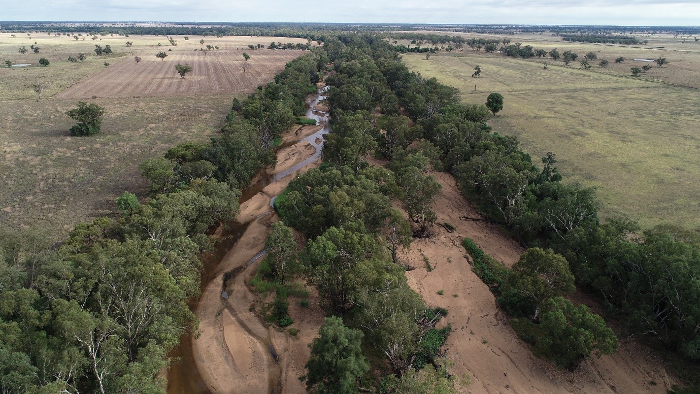
An example of severe channel infilling in the Castlereagh River below Gilgandra is shown below.
The NSW River Styles dataset relies on the River Styles framework to determine levels of channel confinement, channel types, the kinds of controls that limit river channel change and the condition of rivers throughout the state (Following Stage 1 of the River Styles Framework).
From this, Surface Water Science geomorphologists assess likely future channel changes and their potential to recover towards an intact condition. (Aligned to Stages 2 and 3 of the River Styles Framework). 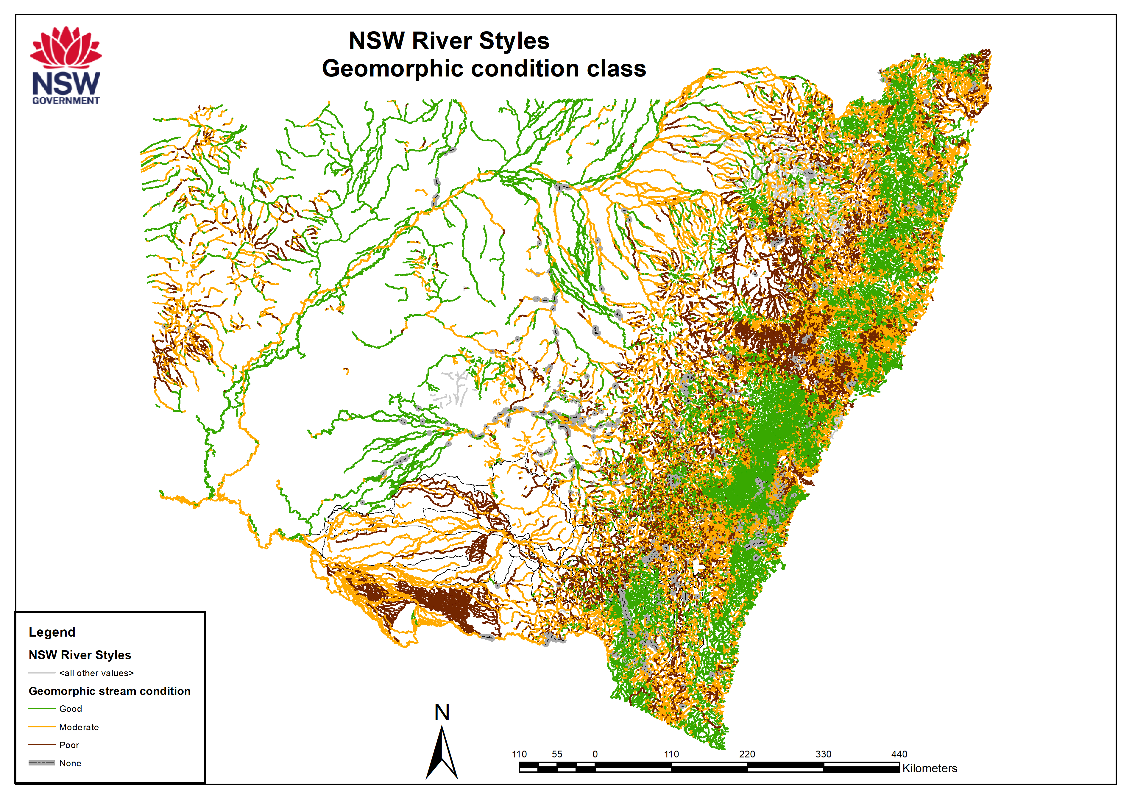
We then identify threats to geomorphic condition and those river sections that threaten intact or high recovery reaches for future management by land and river managers.
The River Styles framework is a project between Macquarie University and the Department of Planning and Energy Water Division. More on the River Style framework can be found here: www.riverstyles.com.
We are working to understand the influence of channel change on long term prospects of river recovery. Rivers in good condition possess variability in channel features to provide habitats and access to water. We study existing channel features to identify ongoing threats to NSW riverine ecological habitats, channel form and pools. This will help to plan for environmental flows and identify priorities for river management.
Linked Datasets
-
The NSW River Styles is a spatial dataset that contains over 220,000 km of river length in NSW and records information (attributes) for each discrete section (reach) of river using ...
- SEED Web Map
- ARCGIS REST SERVICE